The River Deal That Expires This December
India and Bangladesh have split the dry-season Ganges at Farakka under one treaty since 1996. It was signed for 30 years, and it runs out on 12 December 2026.
The story in brief
The Ganges crosses from India into Bangladesh just below the Farakka Barrage, which India built to push water down the Hooghly towards Kolkata’s port. Since 1996, a treaty has split what reaches Farakka between 1 January and 31 May, in ten-day periods, by a fixed formula. It was signed for 30 years, and it says nothing about what happens if the two sides don’t renew it.
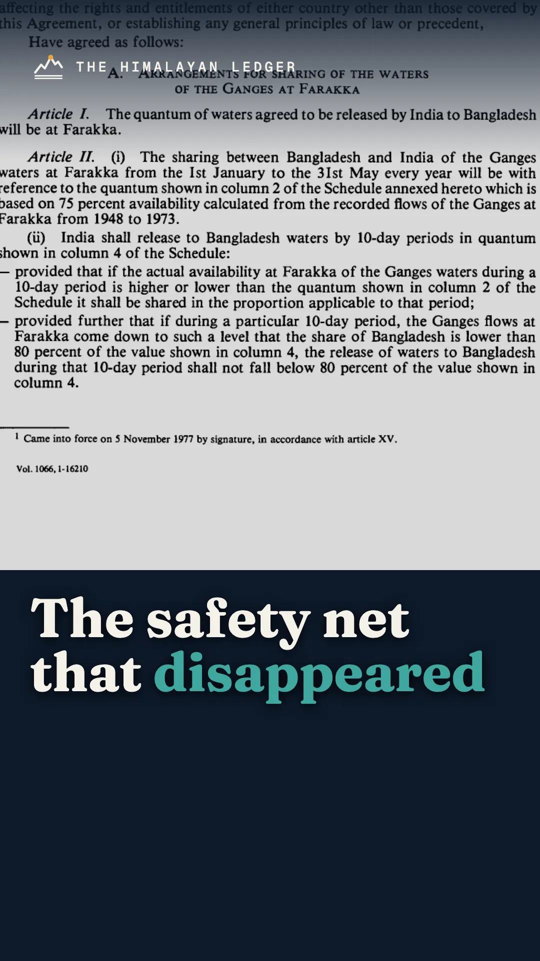
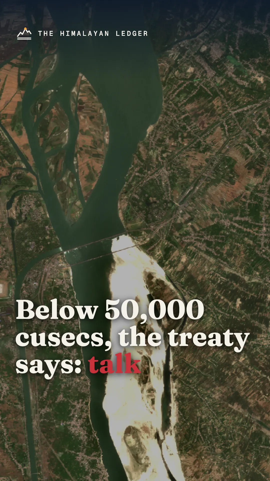
The 1977 agreement that came before it promised Bangladesh at least 80% of its share even in a bad year. The 1996 treaty has no such general floor. Instead, each side gets a guaranteed 35,000 cusecs in alternating ten-day periods in spring, and if the river falls below 50,000 cusecs, the governments simply consult.
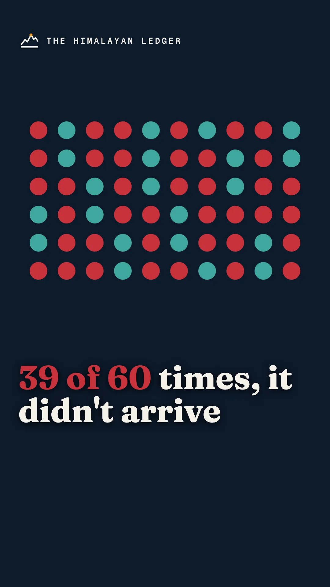
A peer-reviewed study of 20 years of joint measurements (1997–2016) found Bangladesh got less at Hardinge Bridge than India released at Farakka in 39 of 60 guaranteed periods, although the failure rate fell over time. Bangladesh now wants a new or revised treaty with a guarantee clause. India says water matters are discussed within the Joint Rivers Commission.
Key numbers
- 01
12 Dec 2026
The day the treaty's 30-year term ends. It is "renewable on the basis of mutual consent" and says nothing about what happens otherwise.
Ganges Waters Treaty, Art. XII (Government of India copy)12 Dec 1996
- 02
39 of 60
Guaranteed ten-day periods (1997–2016) in which Bangladesh got less at Hardinge Bridge than India released at Farakka
- 03
80% → none
Bangladesh's minimum share in a bad year under the 1977 agreement, and the general floor in the 1996 treaty (our reading of both texts)
1977 agreement (UN Treaty Series vol. 1066); 1996 treaty5 Nov 1977 · 12 Dec 1996
- 04
50,000
Cusecs at Farakka below which the treaty sets no allocation at all; the two governments enter "immediate consultations"
Ganges Waters Treaty, Art. II(iii)12 Dec 1996
- 05
44%
How far below its indicative share Bangladesh received in late March 2010 (474 m³/s instead of 841)
- 06
54
Rivers shared by India and Bangladesh. Only the Ganges has a sharing agreement.
The data
What 20 years of measurements show
The treaty's Joint Committee records daily flows at Farakka and downstream at Hardinge Bridge in Bangladesh. A 2019 peer-reviewed study compared the two for every ten-day period from 1997 to 2016.
Show the numbers
| Period | Value (%) |
|---|---|
| 1997–2001 | 45 |
| 2002–2006 | 36 |
| 2007–2011 | 24 |
| 2012–2016 | 20 |
Source: Rahman et al. (2019), Water Policy 21(2), Table 2, Joint Rivers Commission data.
- Across all 300 periods, Bangladesh got less at Hardinge Bridge than was released at Farakka in 94 (31%). In the 120 critical dry-season periods it was 52 (43%), and in the 60 guaranteed periods, 39 (65%).
- The failure rate fell over time, from 45% of periods in 1997–2001 to 20% in 2012–2016. April was the worst month.
- Our comparison of the two texts: for 21–30 April, the 1977 schedule gave Bangladesh 34,500 of 55,000 cusecs; the 1996 average-year schedule gives 35,000 of 60,992.
Caveat. A gap between Farakka and Hardinge Bridge also reflects what happens on the stretch in between (tributaries, local use, losses). The treaty lets India use up to 200 cusecs there.
Shorts from this story
Sources
Every figure in the video, and where it comes from. We link the original wherever we can.
- 01
Treaty between Bangladesh and India on Sharing of the Ganga/Ganges Waters at Farakka (12 Dec 1996), Government of India, Ministry of Water Resources copy
mowr.nic.in - 02
Agreement between Bangladesh and India on sharing of the Ganges waters at Farakka (5 Nov 1977), United Nations Treaty Series vol. 1066, No. I-16210
commons.wikimedia.org - 03
Rahman, Islam, Navera & Ludwig (2019), "A critical review of the Ganges Water Sharing arrangement", Water Policy 21(2):259-276, CC BY 4.0
doi.org - 04
UN General Assembly decision A/DEC/31/404 (26 Nov 1976)
digitallibrary.un.org - 05
India's Ministry of External Affairs briefing, 9 Oct 2026, as reported by ANI
aninews.in - 06
Bangladesh water resources minister's statements, as reported by The Tribune/ANI and the Dhaka Tribune
tribuneindia.comdhakatribune.com - 07
Joint measurements began 1 Jan 2026, The Daily Star
thedailystar.net - 08
Bihar chief minister on the barrage (Aug 2016), Business Standard (IANS)
business-standard.com
Parts marked as our analysis (for example, comparing the 1977 and 1996 baselines) are our interpretation, not official statistics. The "55,000 cusecs" chart in chapter 5 is an illustration computed from the treaty formula.
Transcript
Read the full narration
0:00 The river deal
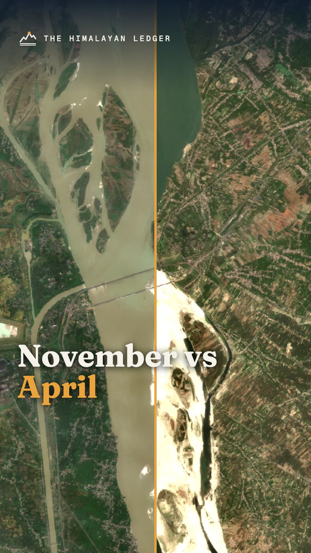
This is the Ganges, at a place called Farakka, in India, on the thirteenth of April this year. Above this line, the river is wide. Below it, there's mostly sand.
And on the left, a canal carries water away, towards Kolkata. Eighteen kilometres downstream, the same river crosses into Bangladesh. Every ten days, from January to May, engineers from both countries measure how much water is getting through.
Not just at the barrage, but again at a hundred-year-old railway bridge inside Bangladesh, called Hardinge Bridge. Because what leaves India and what arrives in Bangladesh are not always the same number.
The rules for splitting it were signed in 1996, for thirty years. Thirty years runs out on the twelfth of December, 2026. Bangladesh wants a new deal with a guarantee. India says talks go through the usual channel.
And the treaty itself doesn't say what happens if the date passes with nothing signed. Hidden inside this treaty is one assumption that decides who runs short first in a dry year.
We'll get to it. First, why is there a wall across the Ganges at all?
1:11 A river and a port
The Ganges starts in the Himalaya and runs about 2,600 km to the Bay of Bengal. 79% of its basin is in India. Bangladesh has about 4%. But that 4% is 37% of Bangladesh's land.
India and Bangladesh share 54 rivers. Only one of them, the Ganges, has a water- sharing treaty. The treaty promised more. Article nine says both governments will conclude sharing deals for their other common rivers.
As of 2019, when the study we'll lean on later was published, the Ganges was still the only one. Here's why. Downstream of Farakka, a branch of the river, the Hooghly, flows past Kolkata.
Kolkata's port depends on that channel staying deep enough for ships. And the Hooghly was silting up. India's answer was a barrage at Farakka: about 2,240 metres of gates across the river, built to push 40,000 cusecs of water down a canal into the Hooghly, to flush the silt out.
It started operating on the twenty-first of April, 1975. In the dry season, 40,000 cusecs is a big share of a shrinking river. And whatever goes down that canal doesn't reach Bangladesh.
2:28 Twenty years of arguments
Bangladesh had agreed to a short trial run. After it, India kept diverting water without an agreement, from June 1975 until November 1977. Bangladesh took the issue to the United Nations.
On the twenty-sixth of November 1976, the General Assembly adopted a decision on what its agenda called the "situation arising out of unilateral withdrawal of Ganges waters at Farakka". A year later, the two countries signed their first deal.
Dhaka, fifth of November, 1977. Five years. It was built around a cautious number: the flow the river reached in three years out of four, from records between 1948 and 1973.
And it had a safety net. If the river ran low, Bangladesh would still get at least 80% of its scheduled share. It also set a three-year deadline for the Joint Rivers Commission to study ways of adding water to the river in the dry season.
The 1996 treaty kept the goal, but set no terms for any joint study. In the last ten days of April, the driest point, that schedule gave India 20,500 cusecs and Bangladesh 34,500. When it expired in 1982, two short memoranda followed.
They kept the shares, but dropped the 80% guarantee. Then, from 1989 to 1996, there was no sharing arrangement at all. In December 1996, the two prime ministers signed the treaty that is still in force today.
4:05 The formula
Here is how it works. The dry season, January to May, is cut into fifteen ten-day periods. In each period, the flow arriving at Farakka is split by a formula. If there's 70,000 cusecs or less, it's split fifty-fifty.
Between 70,000 and 75,000, Bangladesh gets 35,000 and India the rest. Above 75,000, India takes 40,000 and Bangladesh gets everything else. Now, the assumption I promised. The 1977 deal planned around a river that showed up three years in four.
The 1996 treaty planned around the average of forty years, 1949 to 1988. An average sounds fair. But a dry year is, by definition, below average. So the schedule expects more water than a dry year delivers.
On paper, the average year looks like this: over 107,000 cusecs in early January, falling to about 61,000 by late April. Bangladesh's share falls with it, to a low of about 27,600 cusecs in mid-April. To protect the driest weeks, the treaty adds a twist.
Between the eleventh of March and the tenth of May, the two countries take turns: each is guaranteed 35,000 cusecs in alternate ten-day periods. And if the flow at Farakka falls below 50,000 cusecs? The treaty doesn't set a share.
It says the two governments will hold immediate consultations. There's a fallback: if a review produces no agreement, India releases at least 90% of Bangladesh's formula share. But there's no outside referee.
Disputes go to a joint committee, then the Joint Rivers Commission, then the two governments. And one more rule worth knowing. Between Farakka and the point where both banks become Bangladeshi, India may use no more than 200 cusecs of the water meant for Bangladesh.
On paper, it's tidy. Fifteen periods, three tiers, six alternating weeks, a trigger for talks. The question is what happens when the river doesn't follow the paper.
6:20 Thirty years of measuring
So how has it worked? In 2019, Bangladeshi and Dutch researchers published a peer-reviewed study of the official flow records from 1997 to 2016. First, the good news.
On average, the river at Farakka did deliver what the treaty expected. The problem is the dry years. In late March 1997, the ten-day flow at Farakka dropped to about 48,000 cusecs, below the level that triggers emergency talks.
In late March 2010, Bangladesh received about 16,700 cusecs, 44% less than the schedule. In 2016, about 15,600, 47% less. The study then compared what India recorded releasing at Farakka with what arrived at Hardinge Bridge, Bangladesh's measuring point.
In the six guaranteed periods for Bangladesh, the full guaranteed flow didn't arrive 39 times out of 60. That's 65%. April was the worst month.
It was worst in a run of dry years. Between 2008 and 2011, Bangladesh's guaranteed flow fell short at Hardinge Bridge in ten of twelve guaranteed periods. In early April 2010, the flow there was 38% below the guaranteed level.
The researchers say the alternating guarantee itself is part of the problem. When the river is low, handing 35,000 cusecs to one country for ten days means the other gets whatever is left, and then it flips. In the driest years, both countries end up with sharp swings.
There's an important caveat. Between the two points the river gains water from tributaries and loses some along the way, so a gap isn't automatically a broken promise. But historically, the river at Hardinge Bridge carried about 16% more water than Farakka.
After the barrage, that margin shrank to about 9%, and after the treaty, eight. And it got better over time. The share of periods where Bangladesh got less than was released fell from 45% in the treaty's first five years to 20% by 2012 to 2016.
In wetter years, India often released more than the treaty required. Rainfall over the basin hasn't changed significantly in the dry season. Neither has the flow at Farakka. But the dry-season flow at Hardinge Bridge fell significantly after the barrage, and the treaty improved it only a little.
In other words, the river arriving at Farakka hasn't really changed. What changed is how much of it gets past. For Bangladesh, those dry weeks matter: farms, fisheries, forests and river transport in the southwest all depend on that water.
9:05 India's side of the ledger
India has its own pressures. The barrage exists because of Kolkata's port, and the Hooghly still needs water to stay navigable. Upstream, the Ganges is already heavily managed, with dams, barrages and irrigation canals drawing water long before it reaches Farakka.
The 2019 study itself flags rising upstream abstraction as a reason Farakka's flows may fall. And not everyone in India likes the barrage. In 2016, Bihar's chief minister Nitish Kumar said it should be removed, blaming it for silt that worsens floods in his state.
A barrage that India's port wants, that a state upstream wants gone, and that Bangladesh downstream measures every ten days. One structure, three very different complaints. So India is balancing a port, upstream demand, a state government's complaints, and a neighbour downstream.
9:59 December
On the first of January this year, the joint measuring teams started their last season under this treaty. This year, Bangladesh's water resources minister has said Dhaka wants a new or revised treaty, with a guarantee clause like the one in 1977, and access to the data.
He said Bangladesh was prepared to approach international bodies if it had to. He also asked for a right-to-information provision, so Bangladesh can see the data, and said he was hopeful an agreement could be completed before the twelfth of December.
On the ninth of October, India's foreign ministry said river matters are discussed within the Joint Rivers Commission. It has also said technical-level meetings on the Ganges have continued. The researchers who studied thirty years of data suggest three changes: plan for dry years using modelling, not forty-year averages; drop the alternating guaranteed weeks, which they say hurt both countries in dry years; and add a guarantee for Bangladesh when the river falls to extreme lows.
They also say that without a treaty, things could get worse. And the climate question hangs over all of it. Studies project lower dry-season flows across the basin, which would mean more years when the average simply doesn't arrive.
So here's the ledger. For Bangladesh: a lifeline it measures every ten days, and a safety net it lost in the 1980s and wants back. For India: a port, upstream demand, and politics at home.
For both: a river that, in a dry April, simply doesn't have enough for every promise written on paper. The deadline is the twelfth of December. Whatever gets signed, or doesn't, we'll be watching the numbers.
Corrections
None so far. If you spot an error, tell us and we'll fix it here, with the date. How we handle corrections.
Credits
Satellite imagery: contains modified Copernicus Sentinel data 2025-2026 (via Microsoft Planetary Computer). Maps: Natural Earth.
Video: Biswarup Ganguly, CC BY 3.0, via Wikimedia Commons ("BIWTC Ferry Ghat - Paturia - River Padma", "Desi Cargo Boat - River Padma - Goalanda", "Utility Ferry Chandramollika 8 Crossing River Padma", "River Ichamati - Hasnabad-Taki", "Sovabazar Royal Durga Idol Immersion - River Hooghly") https://creativecommons.org/licenses/by/3.0/
Video: Samar Layek, Souhityo Das and Sagor Mondol (Pexels); kanenori and sadekhusein (Pixabay).
Photos: "Construction of Hardinge Bridge 1911" (public domain); "Hardinge Bridge Bangladesh" by Shahnoor Habib Munmun, CC BY 3.0, via Wikimedia Commons.
Music: Pixabay Content License (absolutesound, andriig, moodmode).
Written and produced by The Himalayan Ledger. The narration is an AI-generated voice (Google Cloud Text-to-Speech) reading our own script.
More from the Ledger
· Cybersecurity
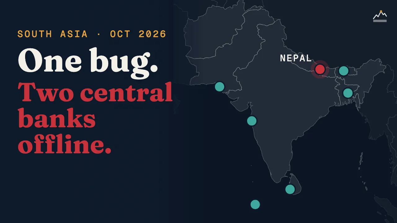
One Bug, Two Central Banks Offline: What Happened in South Asia
On 25 October we tried to open the websites of seven central banks in South Asia. Six opened. No hack was reported; the sites that went dark were switched off on purpose, after two critical flaws were found in PHP.
· Everest
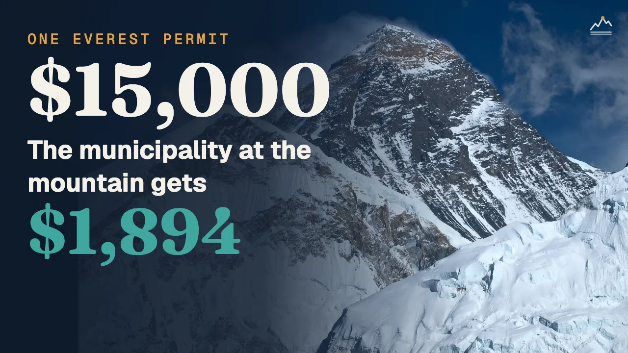
Who Gets the Money From Mount Everest?
Every foreign climber pays Nepal $15,000 to climb Everest. We followed one permit through Nepal's own records, then the rest of the bill, the people who do the climbing, and the mountain's own bill.
· Strait of Hormuz
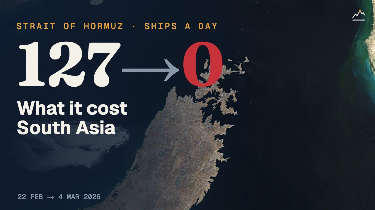
Hormuz: What Seven Months of Shock Cost South Asia
The Strait of Hormuz is nowhere near South Asia, yet seven months of disruption put Sri Lankan drivers on fuel quotas, cut factory hours in Bangladesh and pushed up prices from Karachi to Kathmandu.